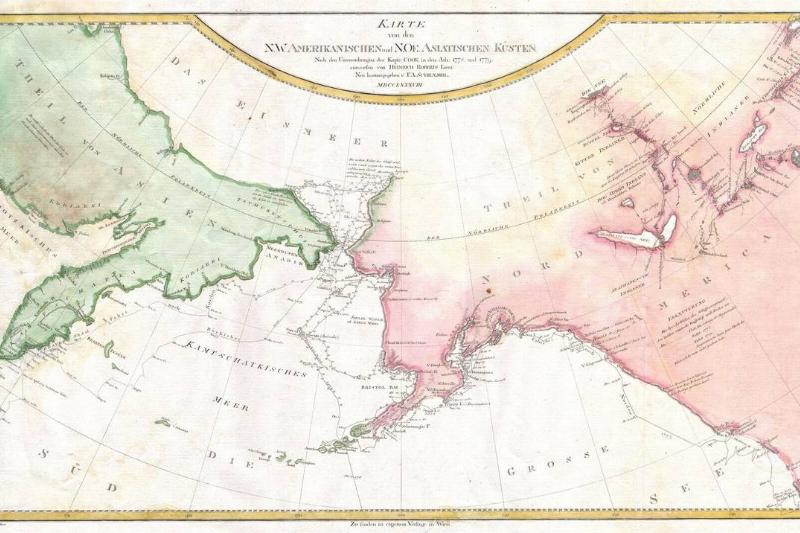
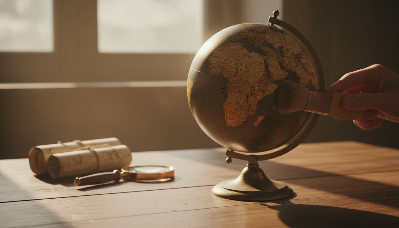
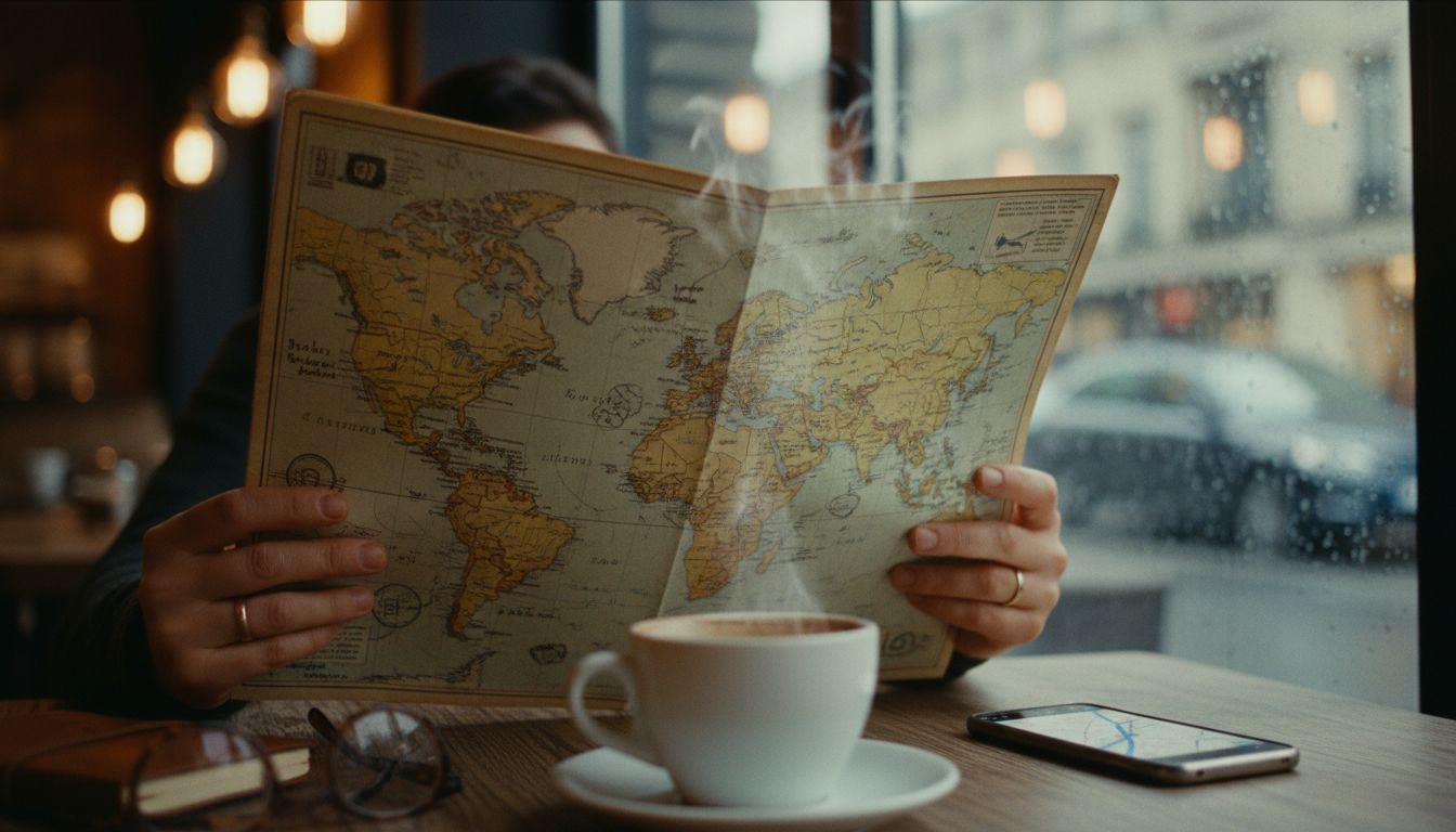
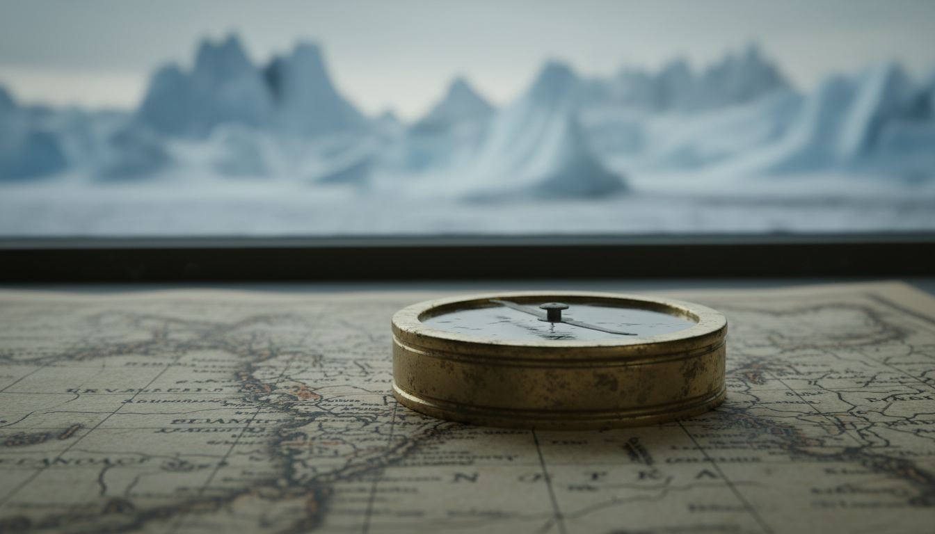
31 Geography Facts That Will Change How You See Earth
Earth is full of strange places, surprising choices, and facts that mess with what you think you know. Spin a globe or pull up a world map and you’ll spot gaps in your knowledge fast. Some things we take for granted are simply wrong, and that’s exactly what makes geography fun to poke at.
Tallest Mountain Depends On How You Measure
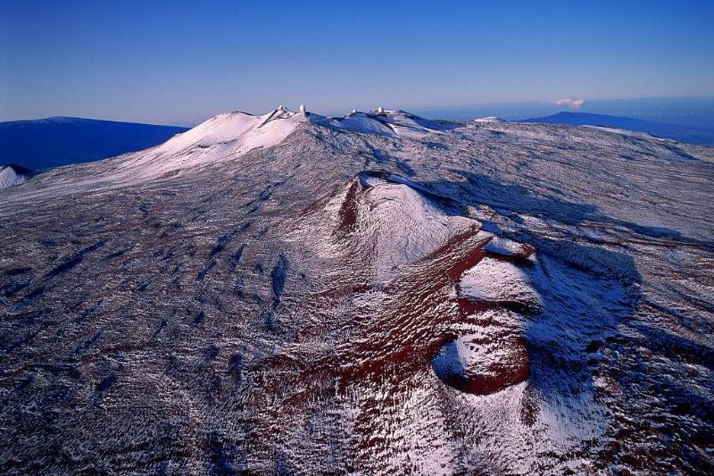
Mount Everest gets the headlines because it is the highest peak above sea level, but that is only one way to count height. Mauna Kea in Hawaii is only about 13,800 feet above the ocean surface, yet measured from its base on the Pacific floor it tops out at more than 32,000 feet. Which mountain is the tallest depends on whether you start at sea level or the deep ocean, so the champion can change with the ruler you pick.
Mexico City's Ground Is Literally Dropping
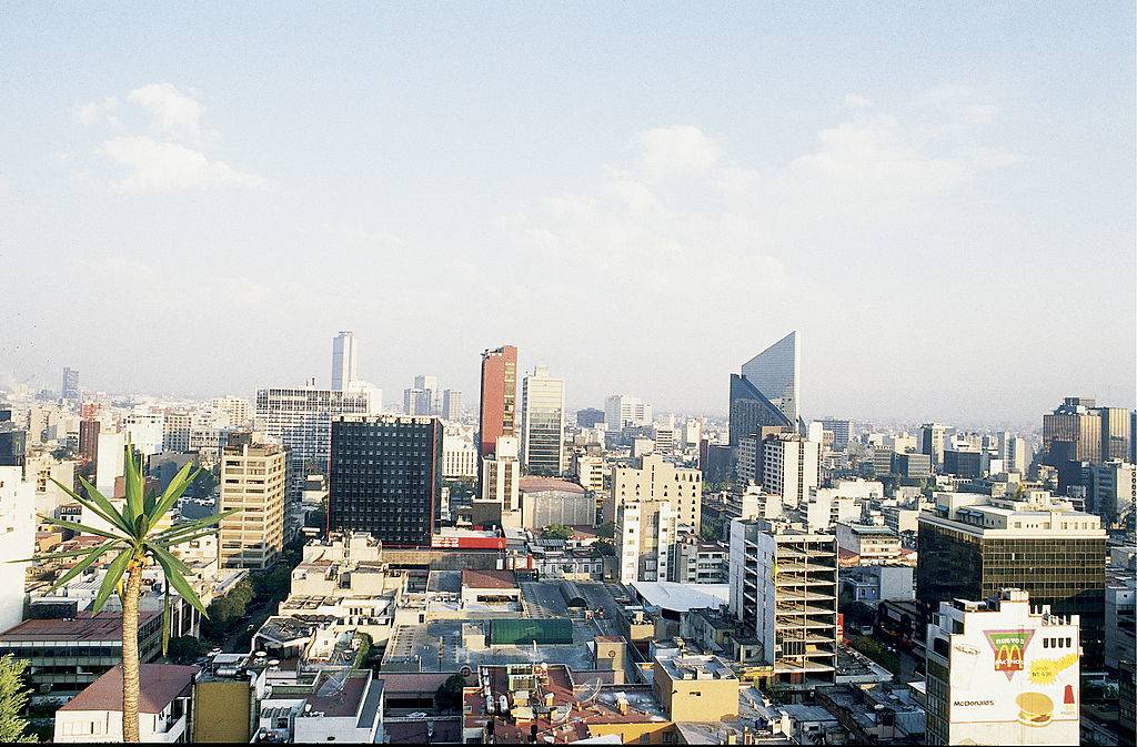
Built on a lake island in 1325 and later overlaid by the Spanish, modern Mexico City sits on soft lakebed sediments. Heavy pumping of groundwater has caused the city to sink, in some spots by about 3.2 feet a year. Over decades that can add up to roughly 32 feet, and keeping roads, pipes, and buildings working is a constant headache.
The Philippines Has Way More Islands
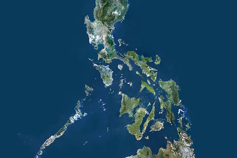
The Philippines really is an archipelago, and recent mapping has pushed its island tally up. New surveys put the count near 7,641 islands, up from the oft-cited 7,107. Better tools and fresh surveys reveal tiny islets that used to slip under the radar, so the number can change as maps get updated.
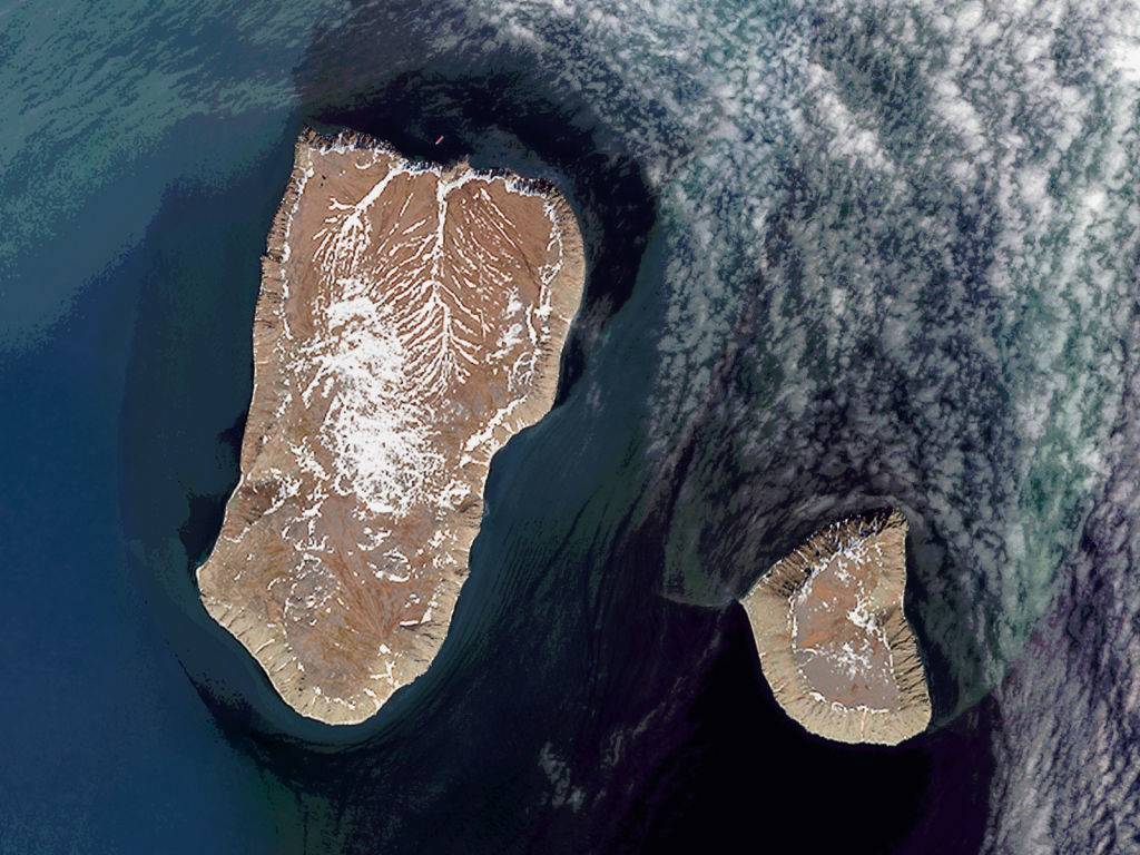
Alaska Is West And East At The Same Time
Alaska looks like the far western edge of the United States, and it is, in a map sense. But the Aleutian Islands stretch past the 180th meridian into the eastern hemisphere, so parts of Alaska are actually the easternmost points of the U.S. Semisopochnoi Island in the Aleutians is technically the easternmost point in North America, a neat reminder that longitude lines can bend your idea of east and west.
Island-Ception In The Philippines
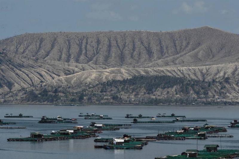
Somewhere in the world, there is an island in the middle of a lake, which is on an island in a lake, that's on an island. Catch that? Located in the Philippines, there is Vulcan Point, which is an island inside of Main Crater Lake. In turn, Main Crater Lake is situated on Volcano Island. Then, Volcano Island is located in Lake Taal, and finally, Lake Taal can be found on the island of Luzon, which is the largest and most populous island in the Philippines.
Morning And Night Happen At The Same Time In Russia

Even considering Russia's massive size, it's still incredible to learn that Russia has a whopping 11 time zones out of the 24 in the entire world! This means that on one side of Russia, the country is waking up at 7 am, while the other side is about to sit down for dinner. A bonus fun fact is that France uses one more time zone than Russia because of all of their different overseas territories.
The Sargasso Sea Has No Coasts
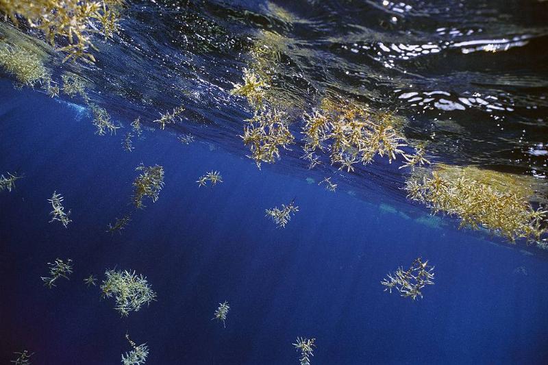
While it may seem obvious that any body of water has to have some kind of coast or ridge line to separate it from a landmass, that's not the case of the Sargasso Sea: the only sea without any coasts. It is located in the Atlantic Ocean in the North, where it is surrounded by four ocean currents, with no land. It is given its name for the Sargassum seaweed that covers it all over.
The Largest Rock In The World Is In Australia
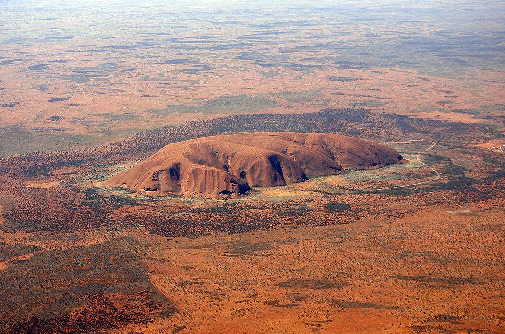
Although it has the name of Mount Augustus, it is not a mountain, but actually one massive rock. It can be found in the Australian Outback, standing more than 2,300 feet tall, and can be visible for more than 100 miles away. Incredibly, this mammoth boulder is more than twice the Ayers Rock's size, which is the much more famous granite rock. On top of all that, Mount Augustus is also 1,650 million years old!
Two Islands Just 2.4 Miles Apart Are Also 20 Hours Apart
In between the United States and Russia are the Diomede Islands, in which the two countries divide. Big Diomede is located in Russia and Little Diomede in America, which are separated by both the International Border and Date Line. However, it is because of this that even though the island is just 2.4 hours apart, there is also a 20-hour time difference between the two. Because of this, Big Diomede is also referred to as Tomorrow Island, and Little Diomede is Yesterday Island.
Damascus Is The Oldest Continuously Inhabited City In The World
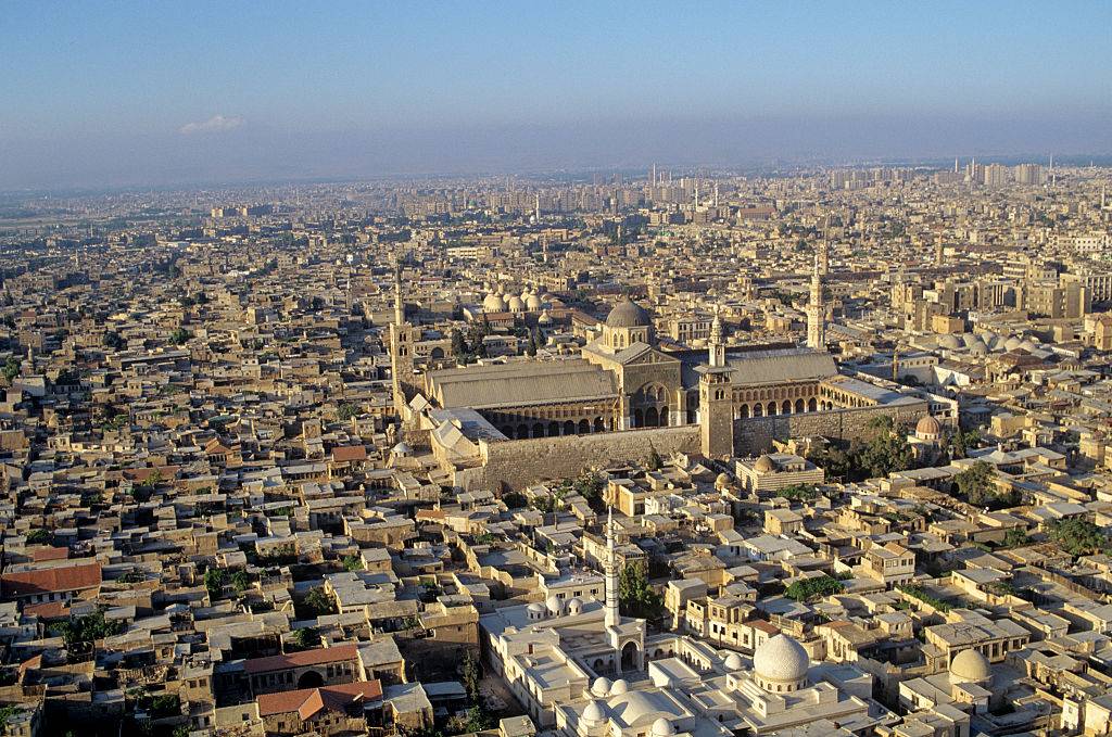
Cities such as Athens and Egypt may come to mind as the oldest cities in the world, but it's actually Damascus, Syria. Since at least 11,000 years ago, it has been continuously inhabited and was eventually named the Arab Capital of Culture in 2008. Today, Damascus has more than 125 monuments from various times in the city's history, going back to the 3rd millennium BC. Currently, the city is home to more than 1.7 million people.
The State Of Kentucky Has More Caves Than Anywhere On Earth
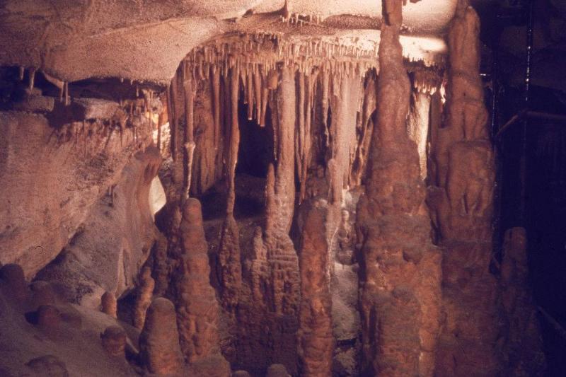
Officially known as the Commonwealth of Kentucky and nicknamed the Bluegrass State, Kentucky is the 37th most extensive and 26th most populous of the 50 United States. Furthermore, it is also home to the world's largest cave system known as Mammoth Cave. The system is more than 400 miles long (of which has been explored), with researchers believing that there are more than 200 miles of unexplored underground systems. Tourists can even visit parts of the cave in Mammoth National Park.
It Snows In The Sahara Desert
The Sahara Desert is considered one of the hottest places on Earth, with temperatures reaching more than 136 degrees Fahrenheit. With the temperatures this high, one would think that this region would never see snow, but that's not the case. While the desert's average temperature is 86 degrees, in the evenings, it can drop to an average of 25 degrees fahrenheit. Unbelievably, in January 2018, it received its third snowfall in 40 years, with the previous being in 2016 and 1979.
A Heart Can Be Seen At The Great Barrier Reef
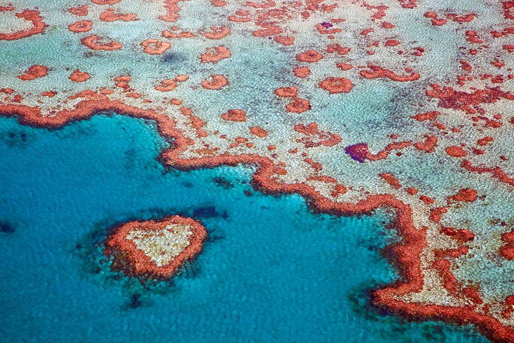
The largest living organism on Earth, the Great Barrier Reef spans 1,429 miles of coastline of Australia. As if it isn't beautiful enough, if you're flying above it, you can see part of the reef that's in the shape of a heart. The first pilot that ever spotted it flew overhead in 1955. The "heart" is 55 feet in diameter and is part of the Hardy Reef in Whitsunday's. Unsurprisingly, you're not allowed to get close enough to it by boat.
Everest Isn't The Closest Mountain To The Moon
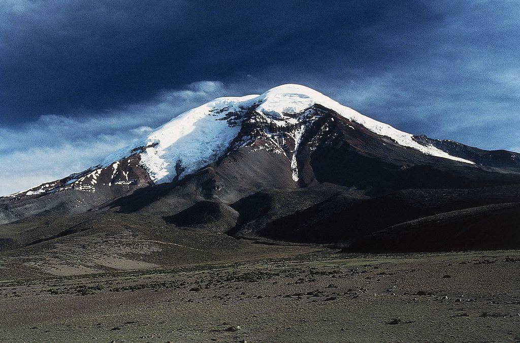
Not only is Mount Everest not the tallest mountain in the world, and even though it's the tallest mountain above sea level, it's also not even the closest mountain to the moon. This prestigious honor, in fact, goes to Mount Chimborazo. This is possible because our planet isn't actually a sphere, as most people think, but actually, an oval inflated in the middle. In Ecuador, Mount Chimborazo may only be 20,564 feet in height, but because the equator pushes it up, it is closer to the moon than Everest by 1.5 miles.
Africa Spans All Four Hemispheres
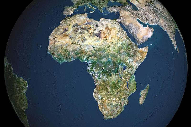
Africa is the world's second-longest and second-most-populous continent after Asia. In total, it covers 6% of Earth's total surface area and 20% of its land area, with a population of 1.3 billion people as of 2018. As if that wasn't impressive enough, it is also the only continent in the world to cover the north, south, east, and west hemispheres, totaling 12 million square miles. Today, Africa is made up of 54 countries, the largest being Algeria.
Water Covers Most Of The Planet Although Humans Can't Use It
Amazingly, the planet is covered by more than 71 percent of water, yet humans can actually consume only .007 percent of it. This is because only 2.5 percent is freshwater, with the rest being saline and ocean-based. Even then, only 1 percent is readily accessible, with the rest of it being trapped in glaciers and snowfields around the planet. That sure is a lot of undrinkable water on the planet!
There's A Piece Of Land In North Carolina That Belong To England
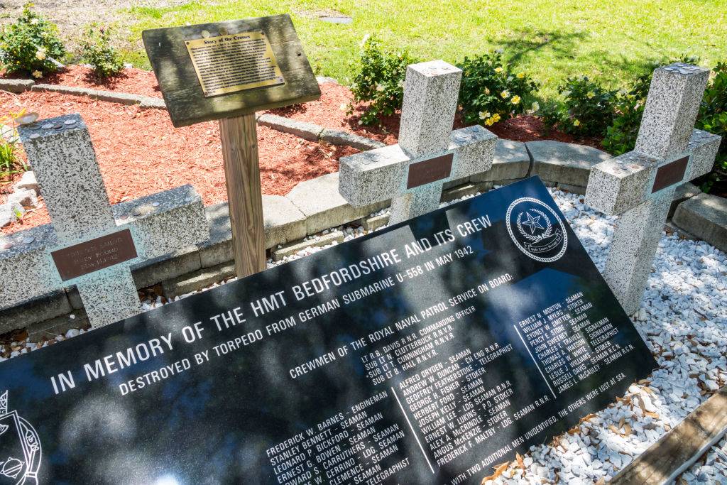
Along the Outer Banks of North Carolina in the town of Ocracoke, is a piece of land that is leased forever to England. The piece of land is a cemetery and memorial that honors the HTM Bedfordshire, which was an English naval ship that patrolled the waters during World War II. When the ship was sunk by a German U-boat, all 37 sailors perished and most bodies were never recovered. However, four bodies did wash on the shore and were buried in a cemetery that was leased to England so the men can be buried on their home ground.
It Takes A Drop Of Water 90 Days To Travel Down The Mississippi River
The Mississippi River is the second-longest river and the second-largest drainage system on the North American continent. The river either borders or passes through Minnesota, Wisconsin, Iowa, Illinois, Missouri, Kentucky, Tennessee, Arkansas, Mississippi, and Louisiana. The river is so long, measuring at 2,348 miles, that it would take a drop of water 90 days from the northernmost source in Minnesota to its end in the Gulf of Mexico. That's a lot of time for a single drop of water!
The Country With The Longest name Has 56 Characters
The United Kingdom's official name is the United Kingdom of Great Britain and Northern Ireland, which is the most characters in a country's full name. However, that wasn't always the case. Libya once held the record at 63 characters when it once went under the name Al Jumahiriyah al Arabiyah al Libiyah ash Shabiyah al Ishtirakiyah al Uzma. Its name was changed in 2013 officially to the State of Libya. We're going to say that's probably for the best.
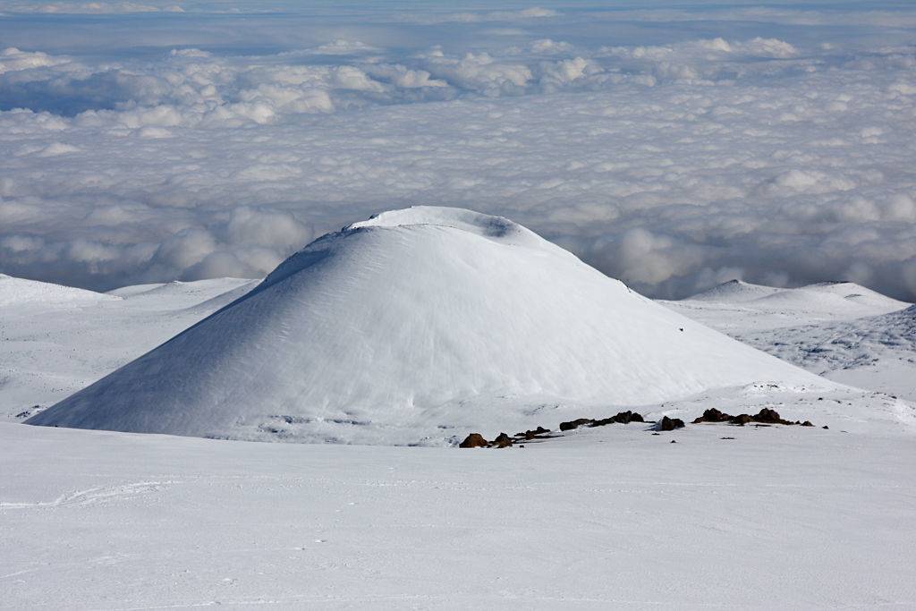
It Snows In Hawaii
Although Hawaii is known for its tropical environment, its volcanoes are tall enough that they appear to be a whole other world at the top, stripped of their palm trees and salty air. They're so tall, in fact, that they even get snow during some parts of the year. For example, Mauna Kea and Mauna Loa on the Big Island, and Haleakala on the island of Maui are all above 10,000 feet and are known to receive snow during the winter months.
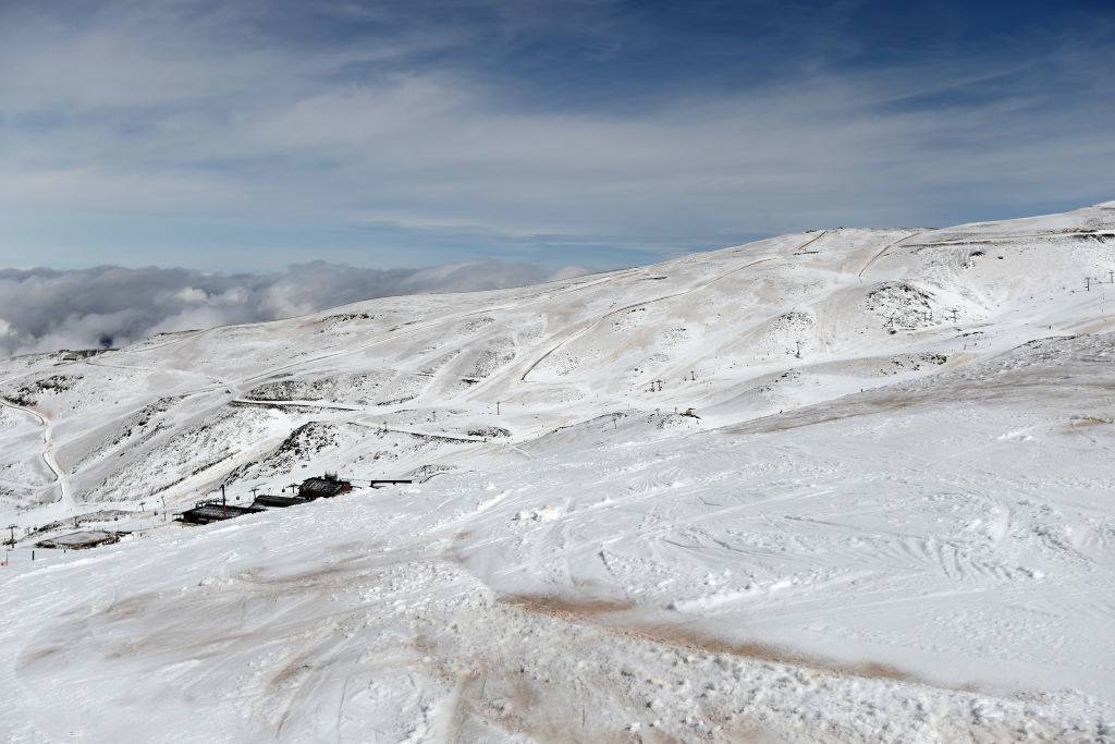
Australia's Alps Get More Snow Than The Swiss Alps
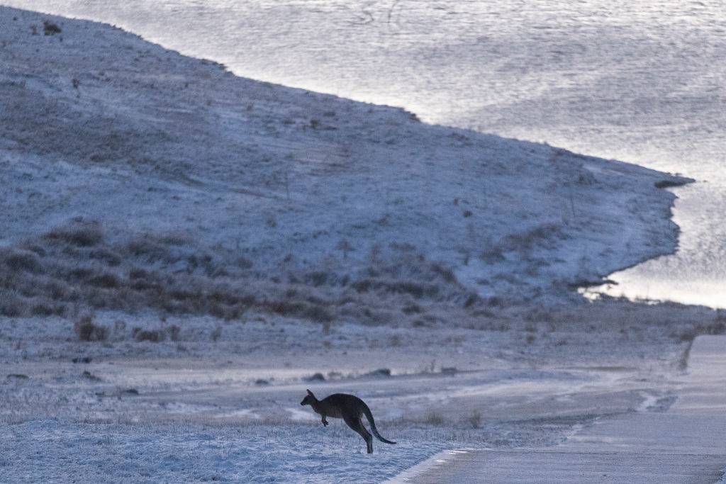
A lot of people assume that Australia is nothing more than beaches and deserts, but they are dead wrong. Along the border of New South Wales and Victoria reside the Australian Alps, which are a popular destination for Australians to have some fun in the snow during the winter months of June to September. If that isn't crazy enough, the Australian Alps actually receive more snowfall than the Swiss Alps because of their proximity to the coast.
There Is A Supervolcano Beneath Yellowstone National Park
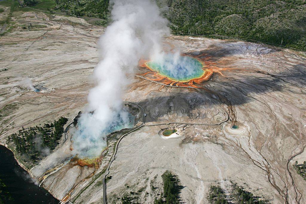
Yellowstone National Park may be considered one of the most impressive in the United States; it's also home to an active supervolcano. According to National Geographic, a supervolcano explosion could release more than 240 cubic miles of materials, around twice the volume of Lake Eerie. The Yellowstone volcano has actually erupted on three separate occasions, although the most recent one was over 640,000 years ago. Unfortunately, this also means that it's overdue, although not likely to erupt anytime soon.
The Largest Sand Island On Earth Is In Australia
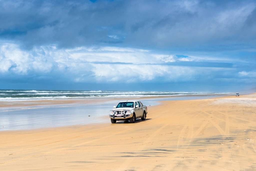
Located in Australia, Fraser Island was formed by sand blowing across the land for thousands upon thousands of years. Its length is around 76 miles with its width being approximately 14 miles. It was established as a World Heritage Site in 1992 and is the largest sand island in the world. It is the traditional land of the Butchulla people and according to the 2016 census, had a small population of just 182 people.
There Are Floating Islands In Peru On A Lake
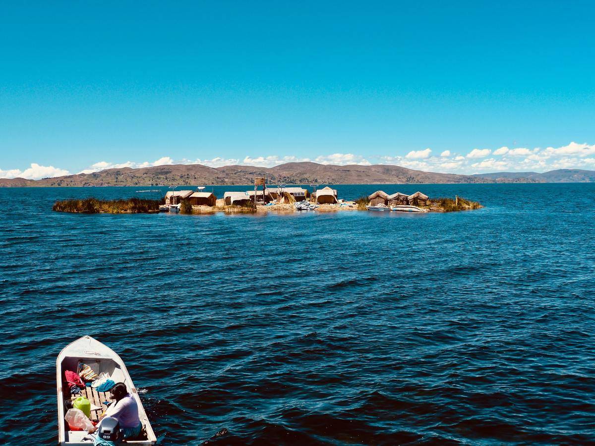
Above Peru in Lake Titicaca is a tribe of individuals that call floating islands made of reeds their homes. By stacking numerous piles of reeds, they create small islands that not only float but can withstand the weight of numerous structures at once. Initially, the small floating island city of Puno was built this way so the people could easily escape danger. However, time never seemed to get to this small village and it has remained more or less the same.
The Shortest Flight In The World Is Just 57 Seconds

Why someone would ever take it, few have few answers, but if you wanted to, the shortest commercial flight in the world can be taken between Westray and Papa Westray in Scotland. The 1.7-mile flight connects the two islands and takes a grand total of 57 seconds depending on the weather. The real question is how much that under one-minute flight costs. It's safe to assume most people buy a ticket just to say they did it.
Los Angeles Is East Of Reno, Nevada
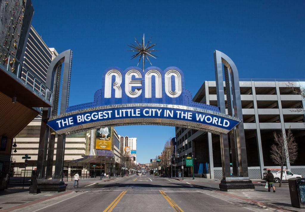
It's common knowledge that California is west of Nevada, considering that it's the westernmost coastline of the United States and Nevada is landlocked. What people don't always realize is that the city of Los Angeles, California is actually East of Reno, Nevada. Los Angeles is actually a whole 86 miles east of Reno, which is crazy to think about when Nevada is around 300 miles from the Pacific Ocean. Don't let logic fool you when it comes to geography!
Istanbul Is The Only Major City That Rests On Two Continents
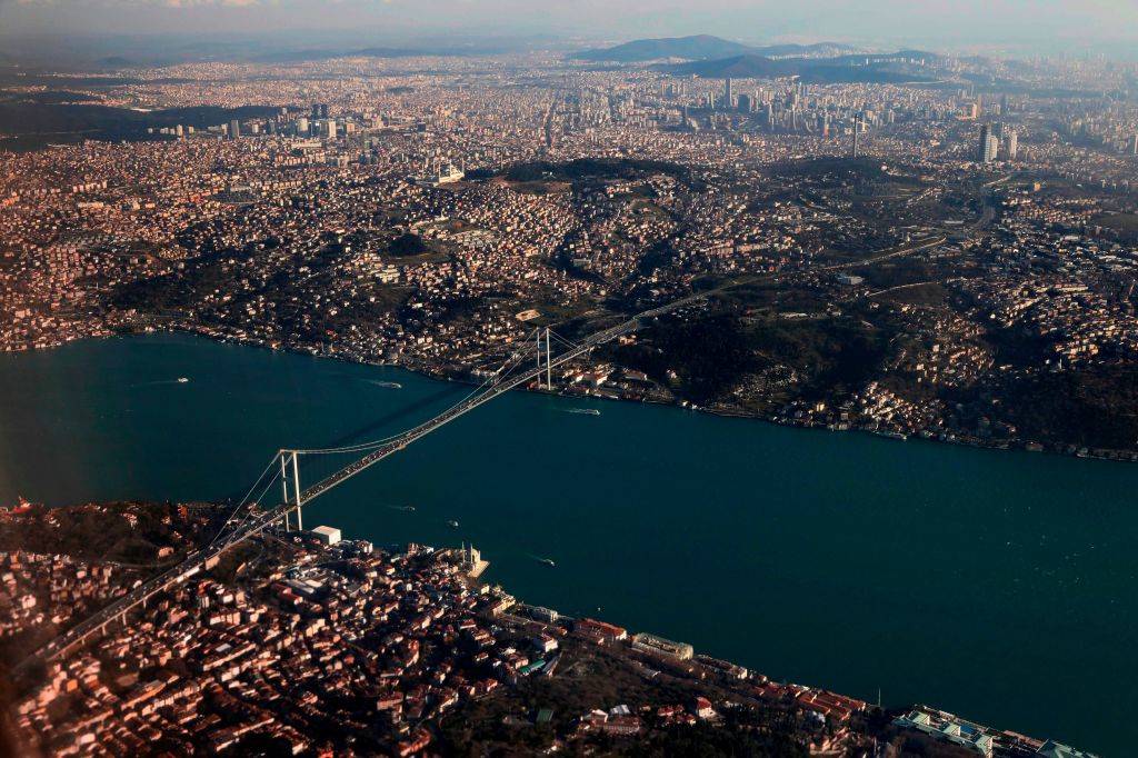
Istanbul is a major city and the only one that is located in both Europe and Asia, with the Bosphorus Strait running right through the middle. A bridge connects the two parts of the city, with the European half being the most populous and serving as the city's historical center. Istanbul is the largest city in Turkey with a history that goes over 2,000 years and as a population of more than 14 million people. In the past, it has served as the capital of the Roman, Byzantine, and Ottoman Empires.
Russia Has The Coldest Inhabited Place On Earth
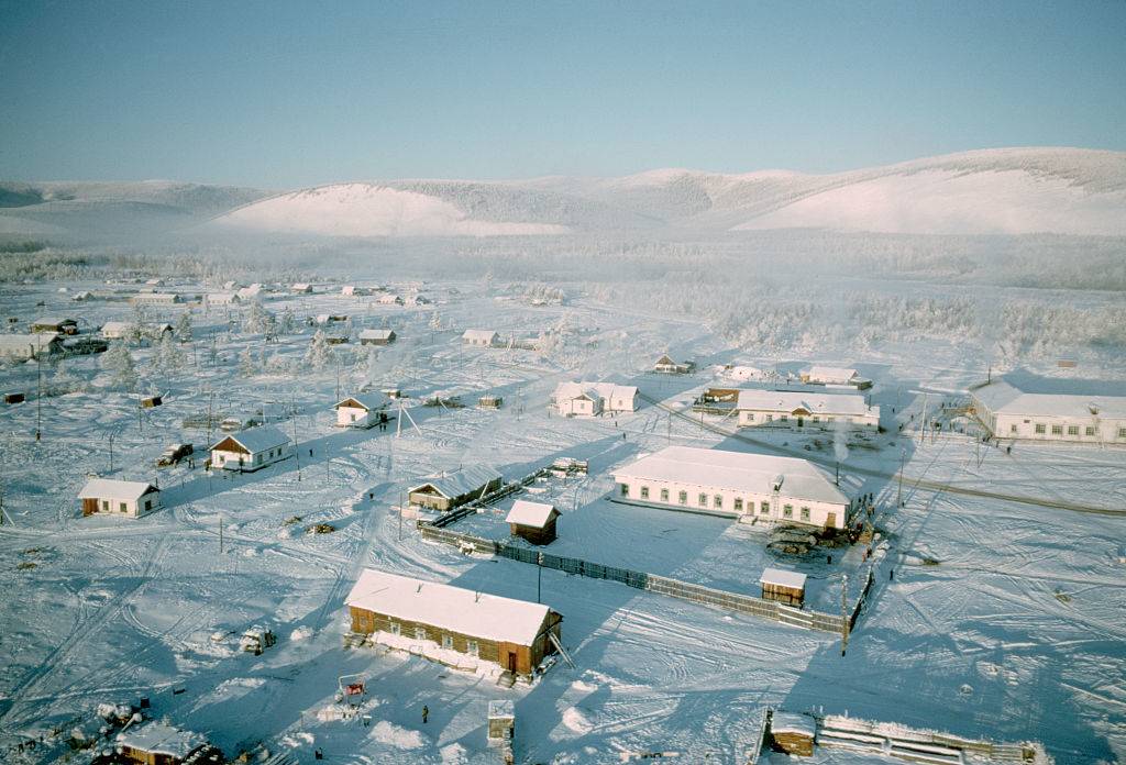
By a stretch, Russia is home to the coldest permanently inhabited place on Earth. This is mostly because the residents of Antarctica do not live in permanent towns, as they move around. This Russian location is Oymyakon, Russia, which in 1924, reached a staggering low of -96.16 degrees Fahrenheit. Nevertheless, this region is not always this cold, and its average temperature resides somewhere around a still bone-chilling -58 degrees Fahrenheit. Hard to believe anyone would want to live there.
Russia And China Touch 14 Countries Each

It's no secret that Russia and China are two of the largest countries in the world, despite the fact that China could fit comfortably in Russia, both each border 14 other countries. Russia, which includes the region of Kalinigrad borders Azerbaijan, Belarus, China, Estonia, Finland, Georgia, Kazakhstan, Latvia, Lithuania, Mongolia, North Korea, Norway, Poland, and Ukraine. On the other hand, China borders Afghanistan, Bhutan, India, Kazakhstan, Kyrgyzstan, Laos, Myanmar, Mongolia, Nepal. North Korea, Pakistan, Russia, Tajikistan, and Vietnam.
Sudan Has More Pyramids Than Egypt
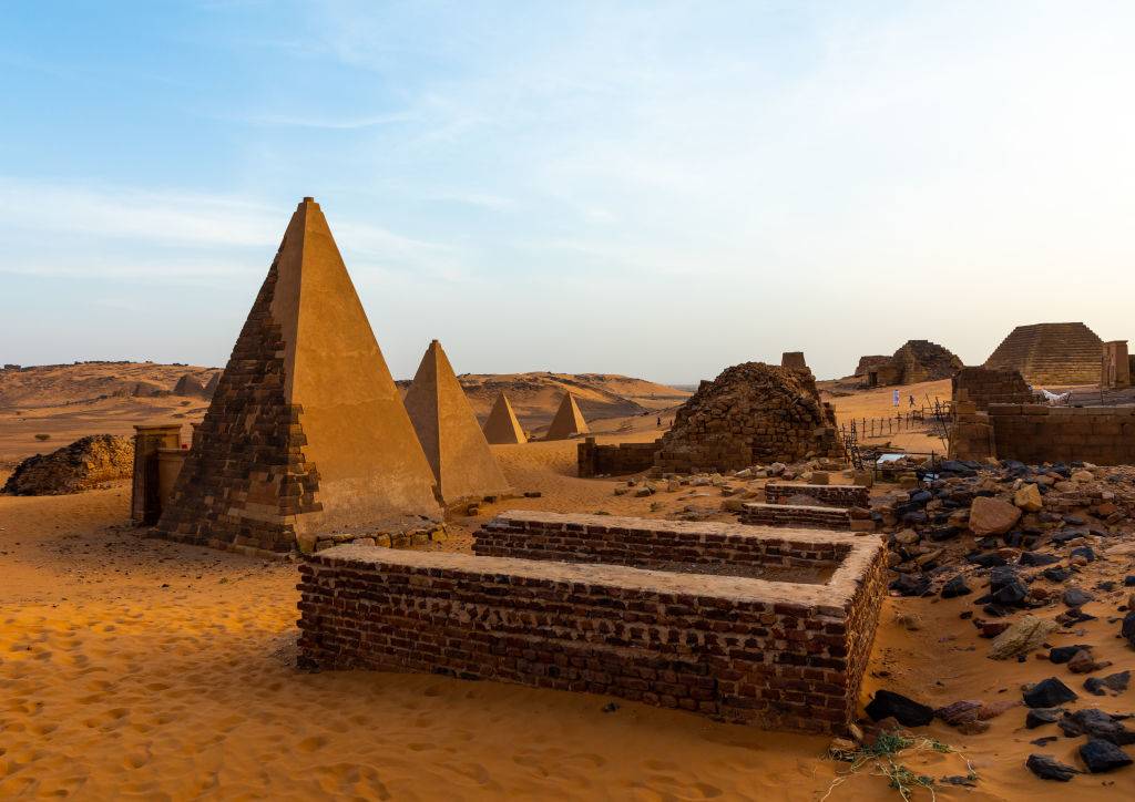
When discussing ancient pyramids, Egypt might come first to mind for most people, being so well known for its Pyramids of Giza. Nevertheless, although Egypt is closely associated with pyramids, Sudan has nearly twice the amount of these ancient structures. Sudan has between 200 and 255 known pyramids, which were built for the Kushite kingdoms of Nubia, which is significantly more than Egypt's 138 pyramids. Today, you can visit Sudan's ancient and reconstructed pyramids of Meroe.
Light Pollution Throughout The Continental United States
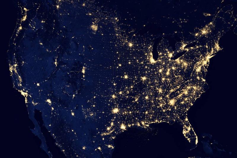
If you're an outdoor lover who enjoys star gazing at night, we recommend venturing to middle and northwest America, where the light pollution is substantially less than the coastal states east of the Mississippi River. Sadly, according to a 2016 study, scientists estimate that around 80 percent of North Americans can't see the Milky Way. But, as geographer Tim Wallace has mentioned, a majority of the states with random light output, such as North Dakota, are due to shale oil extractions and huge commercial buildings, such as airports and power stations.
Here's the Takeaway
This list proves one thing: maps lie in the best possible way. They simplify huge, messy reality into neat shapes and labels, and that makes room for surprises. From mountains that hide most of themselves underwater to cities built on lakes that keep sinking, geography keeps flipping what we think we know. If anything, these facts are an open invitation to get curious again.
Size Is Not What You Think
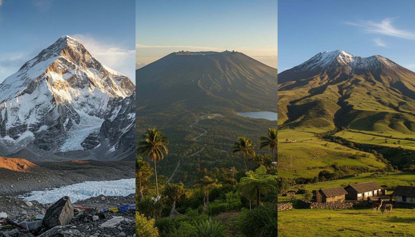
Mount Everest gets the glory, but it is only one way to measure a mountain. Mauna Kea and Mount Chimborazo remind us that height above sea level is not the whole story. The planet bulges, sea levels vary, and a single peak can tell multiple, competing stories about what counts as the biggest or the closest. That kind of trickery is part of what makes geography endlessly fun.
Human Footprints Change Maps
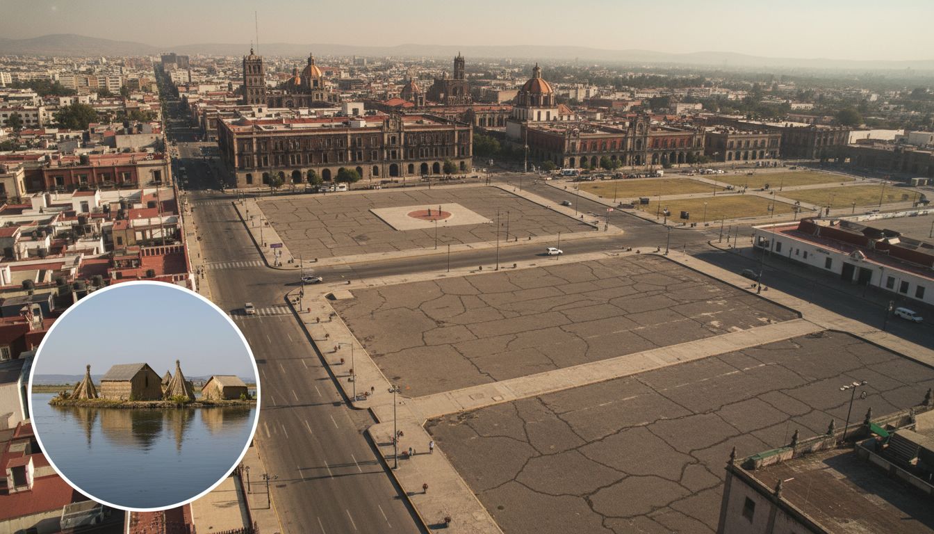
Some geography comes from slow geology, some from human hands. Mexico City sinking because people pump groundwater is a reminder that cities reshape the land beneath them. On the other end, the reed islands near Puno and a cemetery in Ocracoke show how people also make strange, lasting claims on small patches of ground. Those choices show how fragile and bendable the map really is.
Time Zones Play Tricks On You
Longitude is a simple line on paper, but time makes it dramatic. Russia sleeping in one place while having breakfast somewhere else highlights just how big our world is. The Diomede pair, with Big Diomede called Tomorrow Island and Little Diomede called Yesterday Island, is the kind of oddity that forces you to think twice about the date on your calendar. Cities like Istanbul also remind us that geography can split a single place into two worlds at once.
Go Look at a Map Right Now
The quickest way to feel that same surprise again is to spin a globe or open a map and poke around. Check where Los Angeles sits compared with Reno, find the Diomede Islands, or trace a river from its source to the ocean. You do not need to travel far to be surprised, just to look closely and let the planet contradict your assumptions for a while.
An Ancient Patch Of Earth's Skin
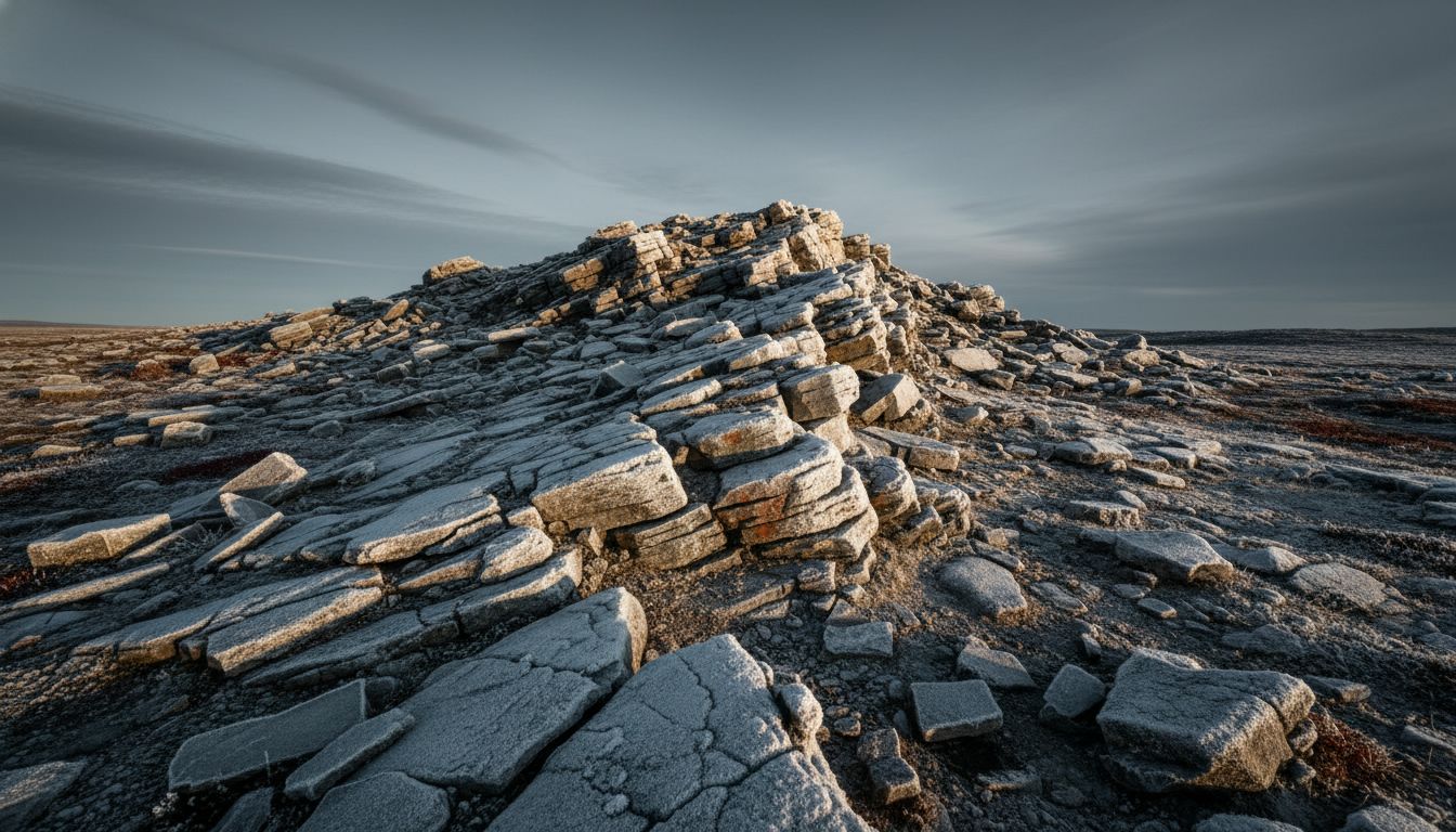
Recent fieldwork uncovered a chunk of crust that may be the oldest we can still see on the surface. Found in northern Quebec and called the Nuvvuagittuq Greenstone Belt, these rocks come from the planet’s earliest era and give geologists a rare peek at how Earth looked when it was just getting started. The find shifts how scientists think continents first stabilized. It is another reminder that the ground under our feet still has surprises.
Point Nemo, The Ocean's Lonely Graveyard
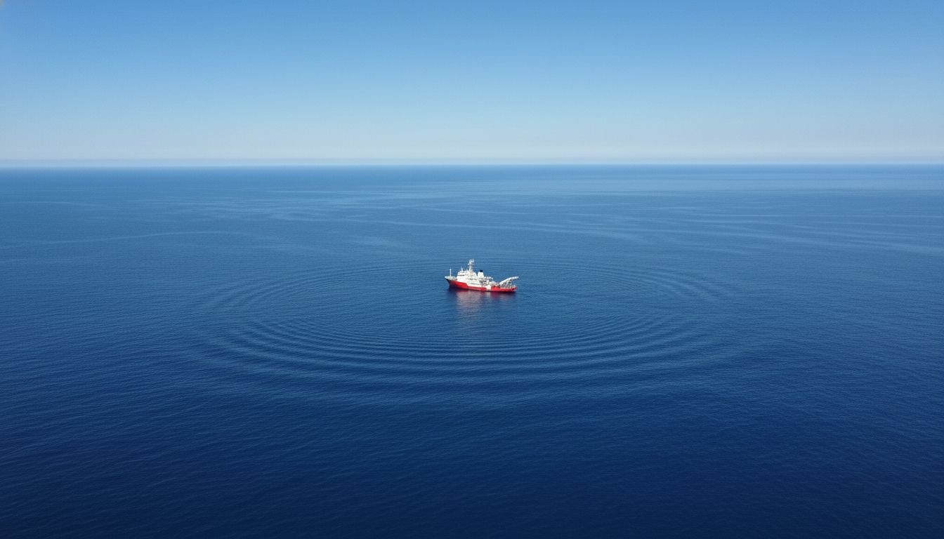
There is a spot in the South Pacific so remote it is often closer to orbiting astronauts than to anyone on land. Point Nemo sits inside an oceanic desert where currents starve the surface of nutrients, and space agencies have used it as a dumping ground for old satellites and stations. More than 260 pieces of space hardware, including parts of Mir, now rest on that seabed. It is geography getting oddly modern.
Life That Never Sees The Sun
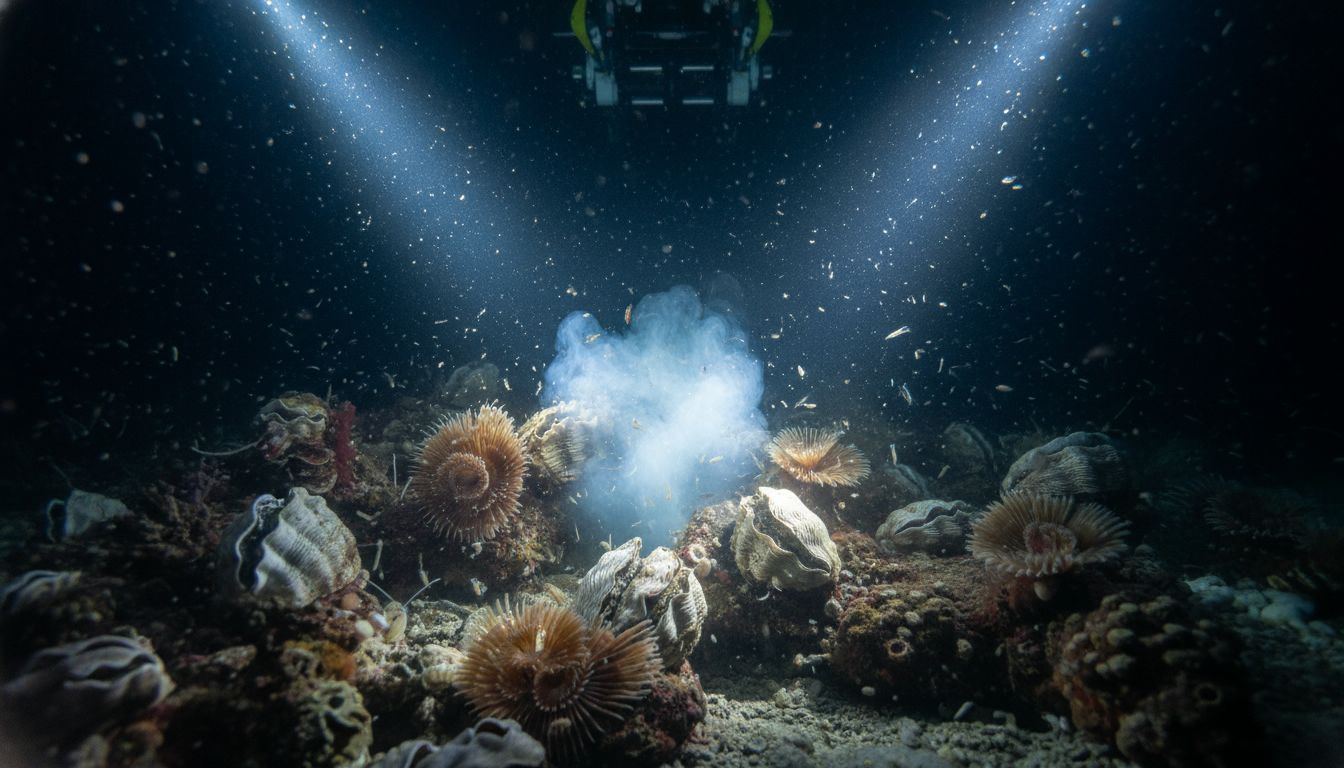
A thriving ecosystem has been mapped far below the ocean surface where no sunlight reaches. Creatures around methane seeps live off chemicals, not photosynthesis, with bacteria hosted in clams and tube worms doing the heavy lifting. The community is dense, strange, and completely independent from the world above. It rewrites what we expect life needs to persist.
The Magnetic North Pole Is Running Off
The Magnetic North Pole is not where it used to be and it is moving fast toward Siberia. That motion, driven by flows in Earth’s outer core, has been accelerating and forced emergency updates to navigation models used by everything from phones to ships. Maps that rely on magnetic north have had to catch up. It shows how the invisible parts of geography can matter every day.
A Hidden Freshwater Ocean Under A Salt Lake
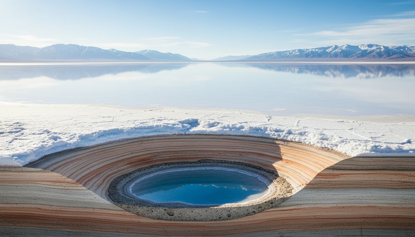
Under the salt crust of the Great Salt Lake researchers found a massive freshwater reservoir trapped in the sediments. It does not change the surface you see, but it does change how we think about water in dry regions. As cities and farms scramble for supply, discoveries like this suggest some 'dry' places hold usable reserves below ground. Geography can hide lifelines where you least expect them.